.jpg) image (10).jpg
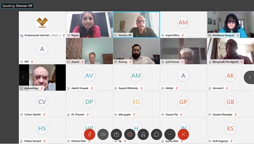
image (10).jpgThe Vivekananda International Foundation held a webinar on 20th August 2020 to discuss a book, Patterns in Past Settlements: Geospatial Analysis of Imprints of Cultural Heritage on Landscapes (forthcoming from Springer). The main speaker of the event was the author of this book, Dr. M B Rajani, Associate Professor at National Institute of Advanced Studies, Bangalore. The purpose of the webinar was to introduce people to the new methodologies being used in archaeological research with the help of modern technologies.
Dr Arvind Gupta, Director VIF initiated the event with an overview of the kinds of advanced technologies being used to discover various proofs of ancient history citing the example of the book, The Lost River: On The Trails of Saraswati where the author Michel Danino highlighted the contributions of ISRO (Indian Space Research Organisation) in finding proofs of the existence of the Sarasvati River in the past by using satellite imaging which helped identify the basin of the Sarasvati River and the various channels of the river.
A discussion regarding the same took place where the overall role of ISRO in creating a database of Indian heritage sites was also discussed. For instance, in the cases of lost rivers there is usually a lot of moisture below the surface of the ground in the areas where the rivers existed which can be identified using microwave radars in satellites which send microwave signals to the ground and use the information that they get back to build an image. Whenever there is moisture below a surface the signals sent back to satellites are distinct from the surrounding surfaces and this can be seen in the consequent images. The Ministry of Culture in India is currently attempting to identify all the cultural sites that are there in India and create a digital database of them using satellite images. This will be used to identify the regions including and around these sites that need to be conserved by making buffer zones depending on the landscapes.
The main event began with a presentation by Dr. M B Rajani, where she introduced her book to the audience. The speaker began by pointing out that modern society has built up a comprehensive database of its existence in the form of the Internet. However, we have no such comparable and large-scale database to refer to when it comes to studying the ancient civilisations. To study our ancestors, we have to scavenge for traces of past human activities that have survived in material forms and develop expertise in interrogating these materials before their secrets fade into oblivion. For this, we have to rely on archaeologists who study ancient materials ranging in scale from fragments of pottery to large artefacts such as individual buildings and even full settlements. This is where researchers have benefited from the scientific and technological advancements that keep expanding the range of ancient materials that are interrogable.
The speaker described her book as an introduction to a branch of archaeology that scrutinises landscapes. She explained that when humans build structures such as forts, road networks etc., they end up scarring the landscapes they build on. Such scars can survive for many centuries and can be supported by past material records which make them worthy of study from an archaeological perspective. While these scars can be difficult to discern on ground level, they are very apparent from an aerial perspective especially via satellite imagery. The speaker then proceeded to show certain ancient maps in comparison to modern maps and satellite images to demonstrate how the patterns of previous constructions continue to exist even today in the overlay of the modern cities. We can identify the old settlements as the scars of their major landmarks and boundaries still remain as a part of the landscapes of our modern cities. This is the case of Bangalore for instance, where the satellite image of the city even today distinctly shows boundaries that were drawn in the 1791 map of the city with a citadel in the south of the area.
Dr. Rajani in her research brought together elements from archaeology, history, art history, architectural history, heritage science, geoarchaeology, geomorphology, remote sensing, GIS (Geographic Information System) as well as cultural heritage conservation and management to create a new methodology for discovering ancient human settlements. The use of such technologies basically allows us to identify what lies beneath the layers of modern human settlement and its significance in the past by studying visual patterns of satellite images and comparing them to the ancient maps. A careful study of a site's vicinity or spatial context can lead to a discovery of further instances or attributes of built heritage as well as the discovery of artefacts such as former water bodies, canals and mounts associated with past human activities at the site. This in turn can help us to identify, recognise, understand and conserve the remnants of our past.
The book also takes into consideration how landscapes evolve over time and the implication of this change for the analysts seeking to identify archaeological features from above. For example, the crop marks found in fields near Stratford St. Mary, Suffolk first observed in aerial photos of World War I turned out to be the surface impressions of a buried fort wall and the adjacent moat. Even in today’s cities one can see traces of past layouts which are inscribed as road or land use patterns. Ruins of a wall for example become a hindrance so people and goods therefore, end up moving around it creating paths which overtime become roads and remain as a permanent marker even as land use on either side keeps on changing. This is how we can still see the cast of the citadel of Lal Qila even today via satellite images of the area. The speaker also mentioned other less explored disciplines of archaeology namely, archeoastronomy (for the study of ancient structures built on the basis of astronomy), military history (the study of old war maps and range of distance weapons during the time period) and coastal geomorphology (use of old maritime charts to study the change in the coastal regions).
At the end of the presentation the speaker highlighted the need for protection of our numerous heritage sites by citing the example of Nalanda which was recognised as a world heritage site by UNESCO in 2016 with a core and a buffer zone. In this case even the buffer zone does not cover the expanse of Nalanda’s remains. The landscape of this settlement that is a huge asset in its understanding is at risk of disappearing.
The webinar ended with the speaker encouraging more scholars to come into the field of archaeology and use advanced technologies available to them as most of these technologies are readily available for free or at very little cost in India.

-
A meeting of the Pakistan Study Group (PSG) was held in hybrid mo
-
On 08 April, the Vivekananda International Foundation (VIF) organ
-

On 15 March 2024, the Vivekananda International Foundation organi
-
On 4 March, the Vivekananda International Foundation (VIF) organi
-
In the emerging quantum world, establishing quantum secure commun
-

The Vivekananda International Foundation (VIF) and Coimbatore Dis
-

On February 21, the Vivekananda International Foundation (VIF) or
-

The VIF under the S&T series organised a talk on “Semiconductor
Post new comment