
Who owns Lipulekh pass and Kalapani? From where does the river Mahakali originate? What is the strategic importance of Kalapani? These are certain questions that have come to the forefront since Nepal raised objections to India’s inauguration of metalled road to Lipulekh pass in April 2020. Why did Nepal raise such a shrill response to a road that is inside India’s territory?
Kalapani is a region in the Pithoragarh district of Uttarakhand astride Nepal’s far western district of Darchula. It is at the trijunction of India, China and Nepal. Lipulekh, located at the height of 5344 meters is a mountain pass from India to Tibet that is ten kilometers to the east of Kalapani. It is in Byans valley of Dharchula region that is a sub-district of Pithoragarh district of Kumaon. The pass is the shortest route to Kailash Mansarovar yatra. Limpiyadhura is at the north west of Lipulekh. Nepal asserts that river Kali (also known as Mahakali or Sarda) originates here, thus the area of Kalapani and Lipulekh belong to it. India asserts that the region belongs to it since the British time and the origin of the river is where Lipugad meets Mahakali on the southern portion of Kalapani hence the eastern ridge is the border. At the heart of the issue is the source of Mahakali River.
River Mahakali is recognized as a border river defining the boundary between India and Nepal by the Treaty of Sugauli signed in 1815. The Treaty was signed after the Anglo-Nepal war of 1814 in which the later was defeated. The cause of the war was to contain Nepal’s expanding army. Towards its west, the Nepali forces under Kazi Amar Singh Thapa had taken over Doti region in 1790. In 1804, the Gorkhas invaded Garhwal and further moved till Kangra valley in 1806 where they were defeated by the forces of Maharaja Ranjit Singh in 1809. Sudarshan Shah, the King of Garhwal, took help from the British forces and defeated the Gorkhas in 1814. The treaty between the two warring parties was signed at Sugauli in the eastern Champaran district of Bihar. It defined the boundaries of Nepal.
According to article 5 of the Treaty, “The Rajah of Nipal renounces for himself, his heirs, and successors, all claims to or connection with the countries lying to the west of the River Kali and engages never to have any concern with those countries or the inhabitant thereof.” Hence, Kali River was recognized as the border in the far west of Nepal.
Nepal lays claim on Kalapani, Lipulekh, Limpiydhura area on the basis of survey of India maps published in 1850 and 1856, which shows that Mahakali originates from Lipulekh. India’s claim on the territory is based on the survey of India map published in 1879 in which Kalapani is shown as its territory. In the minutes of the Joint Working Group of 1998 India claimed that the, “maps prior to 1879 were completed without any scientific and topographical survey and could not be regarded as authoritative or correct”. Since the 19th century, the area has been within India which is acknowledged by British India and the successive governments in Nepal. Locating it within the strategic and commercial interests of British it is highly unlikely that the pass would have been given to Nepal.
The people living in the upper reaches of Pithoragarh district such as Bhotiyas have been using Lipulekh pass for trade purposes with Tibet and continued to use it even after the political changes in the region such as after India became independent from the British and Tibet came under the Chinese control. Main trade of the Bhotiyas was wool, salt and borax. Lipulekh pass was the easiest and shortest pass to Tibet and for centuries the ascetics and yogis have used it for pilgrimage to Kailash Mansarovar. The Pass was never used by Nepal. The route as a trade and transit passage was legitimated by India and China through an agreement on Trade and Intercourse with Tibet signed in 1954, which stated that the traders and pilgrims from both the countries could travel by Lipulekh, “Traders and Pilgrims of both countries may travel by the following passes and route : (1) Shipki La pass, (2) Mana pass, (3) Niti pass, (4) Kungri Bingri pass, (5) Darma pass and (6) Lipu Lekh pass.” It is said that Bhotiyas continued to use the Lipulekh pass even when borders were closed following the Sino-India war. The pass was opened for Kailash Mansarovar yatra from 1982 onwards. Since then the Ministry of External Affairs has been facilitating yatra.
Trade through the route was resumed and the movement of people eased by a memorandum of understanding on the resumption of border trade, signed in December 1991. Next year, a protocol of entry and exit procedure for border trade was signed that recognized Lipulekh as one of the border entry trading point. Lipulekh pass was opened for trade in 1992. In consonance with the 1991 MoU in 2003, Nathula in Sikkim was agreed as another border trading point between India and China. It was opened for trade in 2006 and Kailash Mansarovar yatra from the route began in 2015.
From 2003 onwards a new discourse had emerged in Nepal, which projected its trans-Himalayan linkages with India and China. It wanted to emerge as a transit route and gain benefits from the economic development of its neighbours. Many in Nepal had begun to propose that it was the easiest and shortest route for trade and transit rather than the Indian passes like Nathu La.
In 2014, India and China had identified Lipulekh pass as an additional border personnel-meeting point between the Indian army and the People’s Liberation Army. The next year they agreed to expand border trade at Lipulekh during PM Narendra Modi’s visit to China. Nepal raised an objection to the agreement emphasizing that it was a disputed territory. Probably Nepal’s adverse reaction was also due to the opening of Nathu La for Kailash Mansarovar yatra in 2015. It went against its efforts to be a trans-Himalayan link. Secondly, the country was on the verge of finalizing its new constitution, which was finally adopted in October 2015. Madhesis and Janjaties were upset that the new constitution hadn’t met their demands. India was concerned by the inevitable unrest that could be taken care of by an inclusive constitution taking along all the stakeholders. In this politically surcharged atmosphere the left parties pressurized PM Sushil Koirala to adopt the constitution and raise objections on India China agreement on the expansion of trade at Lipulekh. In fact, on this issue Prachanda had written protest letters addressed to PM Modi and President Xi Jinping and to PM Sushil Koirala. This was the first time Nepal had linked Lipulekh with Mahakali.
In November 2019, India had published a new political map reorganizing the state of Jammu and Kashmir but other boundaries remained as has always been shown since 1947. Nepal raised an objection to the map while asserting claim over Lipulekh pass, Limpiyadhura pass and Kalapani along with Gunji, Nabi and Kuti villages.
The objection became loud after the Defence Minister Rajnath Singh inaugurated Dharchula- Lipulekh road. It is 80 kms long road that starts from Ghatiyabgarh in Dharchula and ends at Lipulekh. Last 5 kms of the road is yet to be completed. Nepal asserted that the road passed through its territory. There were heightened passions within Nepal on the issue of territory. Some had burnt the effigy of PM KP Oli accusing him of not taking timely measures to counter Indian project. Some in Nepal have criticised PM Oli for raising jingoistic nationalism to overcome criticisms on inefficiency in governance or ineffective measures to deal with Covid-19. Nevertheless, majority of them have sided with the voice of nationalism and applauded government for taking stern measures.
Nepal had raised the issue of border in the western sector, for the first time, after the Treaty on Pancheshwar Multipurpose Project was signed with India, in 1996. The discussions on the Treaty had begun by the CPN (UML) government of PM Manmohan Adhikari. However, his government fell and PM Sher Bahadur Deuba from Nepali Congress signed the Treaty. India had insisted on an all- party consensus within Nepal as some of the previous treaties on water had become controversial. However, controversy arose soon after the signing. Some from opposition party CPN (UML) alleged that a different version was signed in New Delhi from the one initialed by the Foreign Ministers of the two countries. The Treaty mentioned, “Mahakali is a boundary river on major stretches between the two countries,” and the opposition demanded clarity on it. Since 1962, Indo-Tibetan border police is deployed at Kalapani and UML had asked for force withdrawal. Nepali Congress and Rashtriya Prajatantra Party tried to dissuade UML from such an opposing stance.
Domestic politics in Nepal is an important variable affecting its relations with India. In the present context Prime Minister Oli is facing challenge from his own party members on myriad of issues. It is said that there was a gentleman’s promise at the time of the merger of CPN (UML) and the UCPN(Maoists) to form Nepal Communist Party (NCP) in 2018, that Prime minister would be on rotation between KP Oli and Pushpa Kamal Dahal (Prachanda). Both are also the co-chairmen of NCP. Oli has been under pressure to make way for Prachanda. There are also voices on `one man, one post’ principle. In order to consolidate his position PM brought in two ordnances without discussing within the party or cabinet. One ordinance would have done away with the requirement to split party by getting 40% support in both the party central committee and the parliamentary party. The amendment would have allowed parties to split by garnering 40% of support either in the central committee or the parliamentary party. The second amendment allowed PM to convene constitutional council meeting without the participation of the main opposition party leader. President Bidya Bhandari had approved the ordinances but repealed them amidst growing criticism. Newspapers from Nepal have reported that the game plan was to help one faction of Samajbadi party to split, which would have given support to Oli. Contrary to his expectations, the Samajbadi party and the Rashtriya Janata party merged to form Janata Samajbadi party.
At this juncture, Prime Minister raised objections on the political map of India and later the inauguration of road to Lipulekh. This issue of infringement of Nepal’s sovereignty and territory gave a breather to Oli. Rousing public sentiments was easy as the border blockade of 2015 is still fresh in the public memory.
During the political squabble in Nepal, the Chinese embassy was involved in negotiations between the leaders of Nepal Communist Party. Press in Nepal reported that the Ambassador of China, Hou Yanqi held separate meetings with the leaders of NCP amidst growing challenge to Oli’s leadership. This and other moves by China have led many in India to understand that Nepal government took action at the behest of someone. As such, the Chinese presence is increasing in Nepal.
Prime Minister Oli’s personality should also be assessed while understanding the current imbroglio. He has often been compared with King Mahendra. His rule had seen the rise of Nepali nationalism and the policy of using China as a balancer to India. Oli has taken this comparison too seriously and has used the strategy successfully to his advantage. Unhappy with the fall of his government in 2016, he had stated that “India was primarily behind it” and the change in government was "not an automatic process but conducted by remote control". During his tenure he had developed close relations with China and signed various agreements on infrastructural linkages, trade and economy. After his resounding victory in 2018 election, the Chinese presence has substantially increased; be it in use for the domestic politics or in his dealings with India.
With this act of nationalism PM Oli has turned the present crisis to his advantage and consolidated his position within his party. Interestingly even the opposition parties have extended support to the government on the issue of Lipulekh. It is alleged that sword of Damocles in the name of human rights violation during the people’s war or corruption charges is hanging over some of the senior leaders within the ruling party or in opposition.
On May 20th, Nepal had published a new map that has included Kalapani, Limpiyadhura and Lipulekh within its territory. A constitutional amendment bill was presented in the lower house of parliament to change the coat of arms in accordance to the new map reflecting the inclusion of the new territories. The bill was unanimously passed by both the houses of the Parliament and approved by the President.
The territorial issue is no more within the domestic political confines of Nepal. The support of parties and people has constricted the space for any government to ignore the issue. If left unresolved, any interested actor could use it for domestic political gains. As such the political actors in Nepal have used India for their domestic political consumption.
India and Nepal have resolved most of the border related issues through bilateral border mechanisms. This issue, however, needs political outcomes and solutions.
Different border points have their own lived-in history and complexities and policies should be made accordingly. It is important to see the historicity of the border, which has been a live route for the border people of Pithoragarh. Aspirations of the border population need to be taken into consideration. This aspect should be reflected in the negotiations as and when the two sides meet.
(The paper is the author’s individual scholastic articulation. The author certifies that the article/paper is original in content, unpublished and it has not been submitted for publication/web upload elsewhere, and that the facts and figures quoted are duly referenced, as needed, and are believed to be correct). (The paper does not necessarily represent the organisational stance... More >>
Image Source: https://timesofindia.indiatimes.com/india/why-are-india-nepal-fighting-over-kalapani/articleshow/73081212.cms
-

The general elections for the National Majlis (Parliament) of Mal
-

India possibly can boast of having one of the largest (nearly 35
-
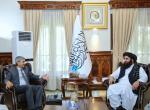
Following the visit of an Indian delegation to Afghanistan in Mar
-

The plenary sessions of the Chinese People’s Political Consulta
-
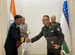
Background Chief of Army Staff (COAS) of the Indian Army, Gene
-
Premise This work attempts to analyse the following premise:-
-
Modi is the first and only Prime Minister to place before the peo
-

From being an intensely hated person, he has become the most admi
Post new comment